Cape Kamui
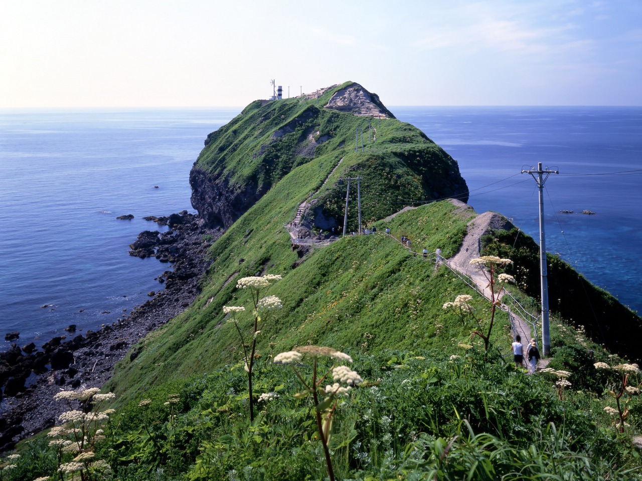
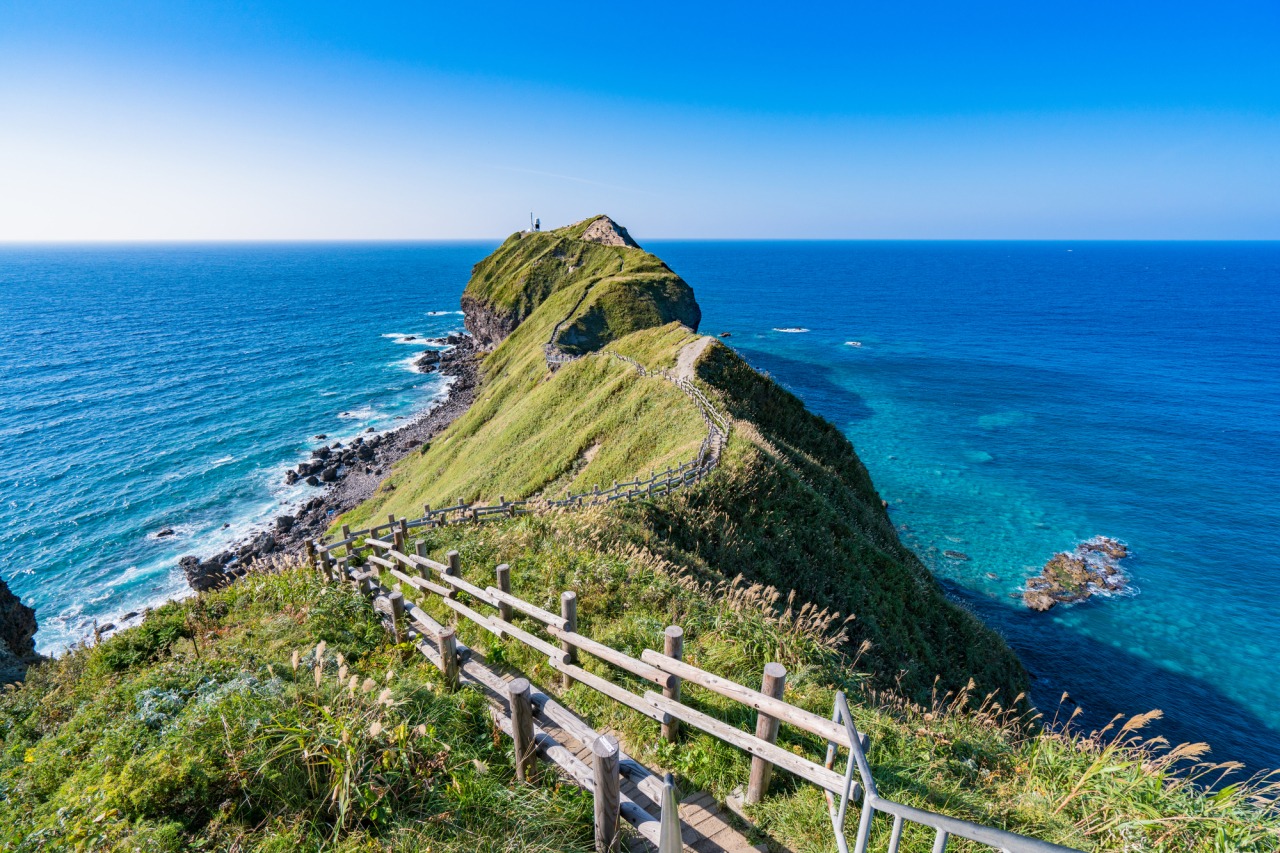
A 300-Degree Horizon Atop 80-Meter Cliffs
Experience the breathtaking "Shakotan Blue" on a dramatic walk above the Sea of Japan.
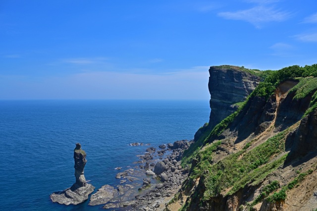
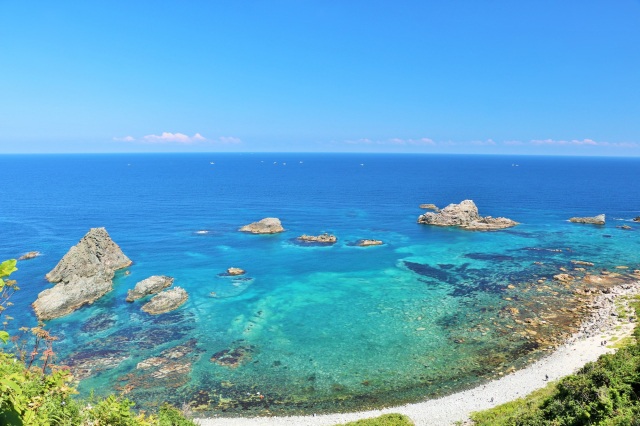
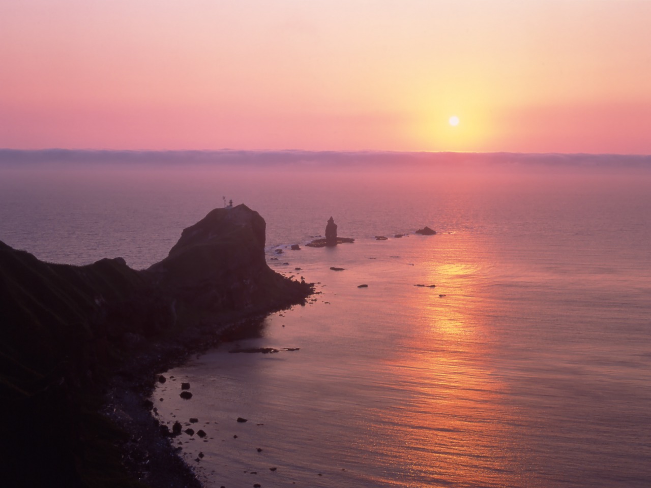
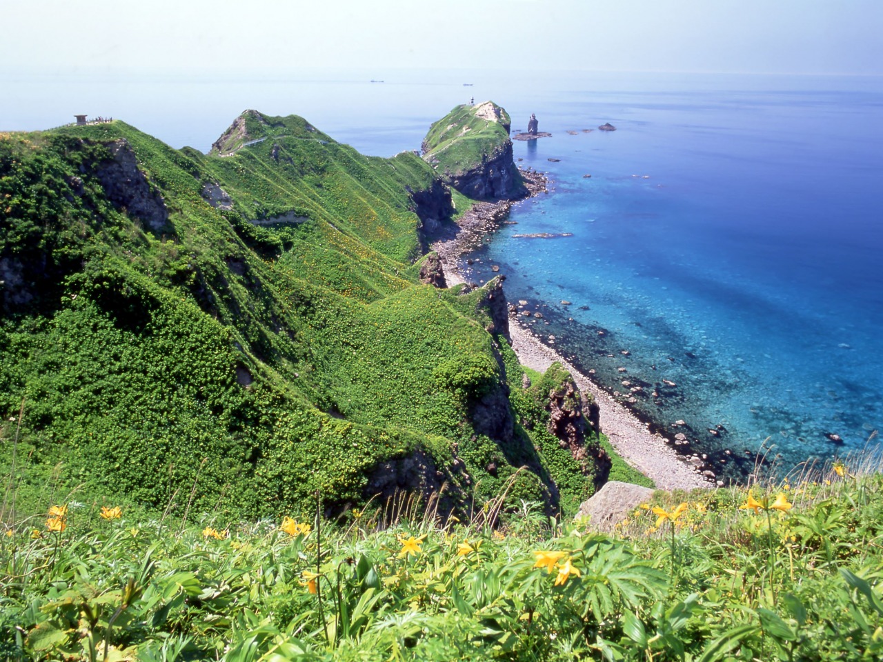
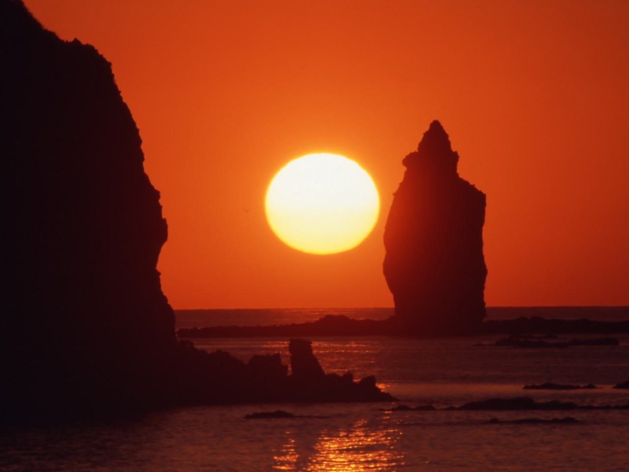
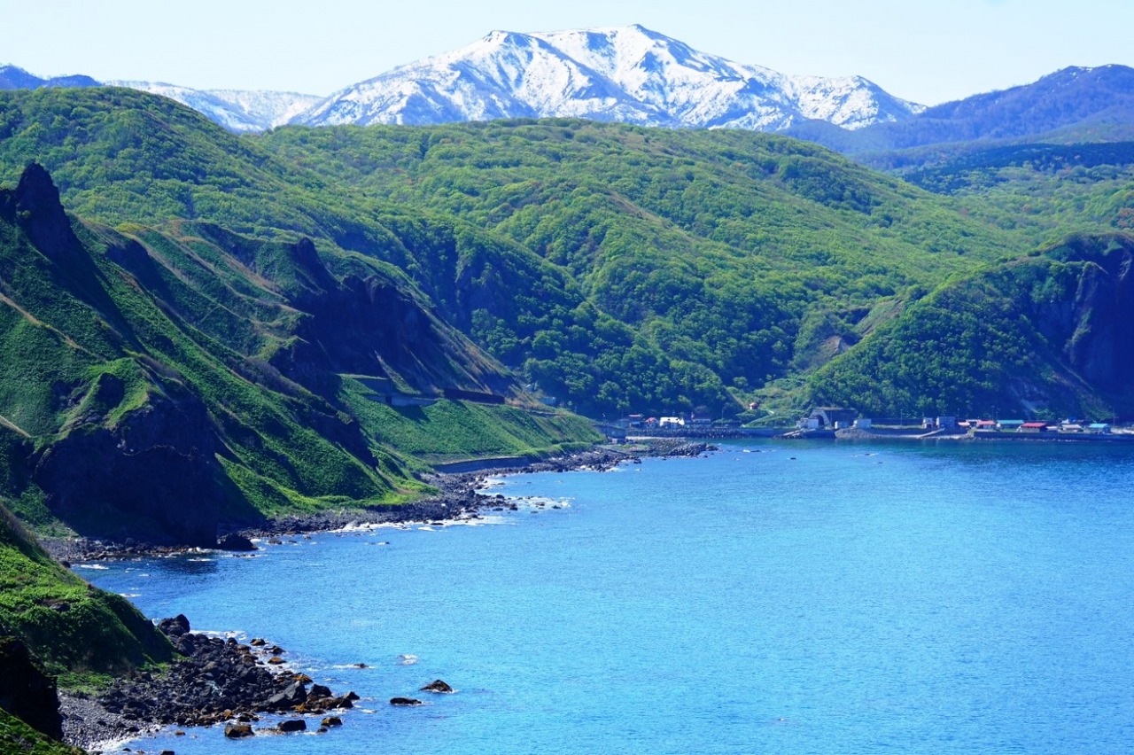
Cape Kamui, located at the northwestern tip of the Shakotan Peninsula, is a majestic headland surrounded by 80-meter-high sheer cliffs. It is famous for the "Shakotan Blue," a stunningly clear and vibrant turquoise sea that stretches as far as the eye can see.
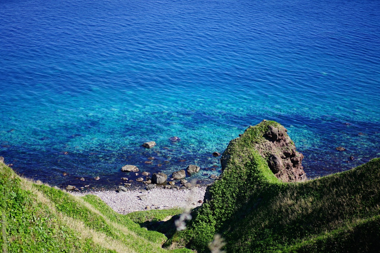
The journey to the edge of the world begins at the parking area, where the Charenka Trail winds about 770 meters toward the tip of the cape. As you hike the undulating path, lush bamboo grass sways in the wind, and a refreshing sea breeze brushes your face. Below, the crystal-clear water reveals the hidden depths of the ocean floor.
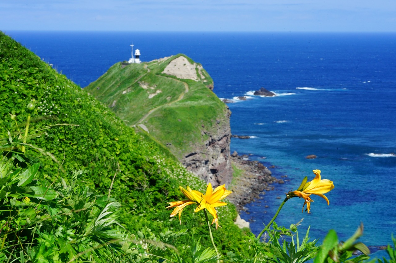
After a rewarding 20-minute walk, you arrive at the tip of the cape—a spectacular vantage point offering a 300-degree panoramic view. Standing atop the rugged cliffs, you are embraced by an endless expanse of blue where the sea meets the sky. In the serene silence, broken only by the rhythmic crashing of waves, you will notice the subtle curve of the horizon, a powerful reminder of the Earth’s vast scale.
The ocean’s hue transforms with the light and weather. On sunny days, the water displays a magnificent gradient, shifting from deep indigo to brilliant emerald green. On breezier days, the scent of salt fills the air as white spray dashes against the rocks. This is more than just a view; it is a profound encounter with nature that stays with you long after you leave.
- * Please note that the text shown on this page includes machine translations.
- Category
- With friends
- World Heritage sites, Jomon culture, Ainu culture
- History, culture, art
- Shooting locations of films, dramas, or commercials
- Solo trip
- Guys' trip
- Girls' trip
- Couple
- Family
- Travel style
- Sea of clouds, sunset, night views
- Sea, coast, cape, peninsula, island
- Red leaves, scenic spots, observation platforms
- Natural scenery, spectacular views
- Visit seas, rivers, and lakes
- Nearest airports


General Information
- Postal code
- 〒046-0321
- Address
- 北海道積丹郡積丹町神岬町
- Telephone Number
- 0135-44-3715(Shakotan Tourism Association)
- Open
- [Kamui Banya] Restaurant/11:20-15:30, Shop/10:30-16:00
- Car Park
- 200 spaces, Free
- Directions
- ●By car: About 70 minutes from JR Yoichi Station
●By car: About 90 minutes from JR Otaru Station - Website
* Information on facilities is subject to change. Please check each official website for the latest information.
![[New Chitose Airport IN & OUT / 1 Night 2 Days] Nikka Yoichi Distillery, Cape Kamui and Sea Urchin, Otaru Canal - A Refreshing Drive Through Yoichi, Shakotan, and Otaru](/lsc/upfile/course/0000/0038/38_1_s.jpg)