Search conditions
Category
Area
Central Hokkaido
- Sapporo/Jozankei
- Sapporo Hitsujigaoka Observation Hill, Mount Moiwa, Hoheikyo Dam, etc.
- Area around Sapporo
- Lake Shikotsu, Northern Horse Park, Lake Katsurazawa, etc.
- Area around Otaru, Niseko
- Otaru Canal, Shakotan Peninsula, Mount Yotei, outdoor experiences, etc.
- Area around Toya, Noboribetsu, and Hidaka
- Lake Toya, Mount Usu, Jigokudani, Cape Erimo, etc.
Southern Hokkaido
- Hakodate, area around Hakodate
- Mount Hakodate, Hakodate morning market, Goryokaku Park, Onuma Quasi-National Park
- Matsumae, Esashi, Okushiri
- Matsumae Castle, Former Nakamura Family Merchant House, Okushiri Island
Northern Hokkaido
- Asahikawa, Sounkyo, Tenninkyo
- Asahiyama Zoo, Kurodake, Asahidake, Tohma Limestone Cave, etc.
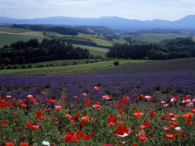
- Area around Furano, Biei
- Lavender Farm, Blue Pond, Unkai Terrace, etc.
- Wakkanai, Rishiri, Rebun, Rumoi
- Cape Soya, Path of White Shells, Rebun Island, Rishiri Island, Kunimare Sake Brewery, etc.
Eastern Hokkaido
- Shiretoko, Abashiri, Monbetsu
- Shiretoko Five Lakes, whale watching, drift ice, Abashiri Prison Museum, Road to the Sky, etc.
- Tokachi, Obihiro
- Gardens, Mikuni Pass, Lake Shikaribetsu, Lake Onneto, etc.
- Kushiro, Lake Akan, Lake Mashu, Nemuro
- Kushiroshitsugen National Park, Lake Akan, Lake Mashu, Lake Kussharo, Cape Nosappu, etc.
Distance
検索結果
We found 305 results
- Sort by
- Popularity
- Last Updated Date
- The Closest Location
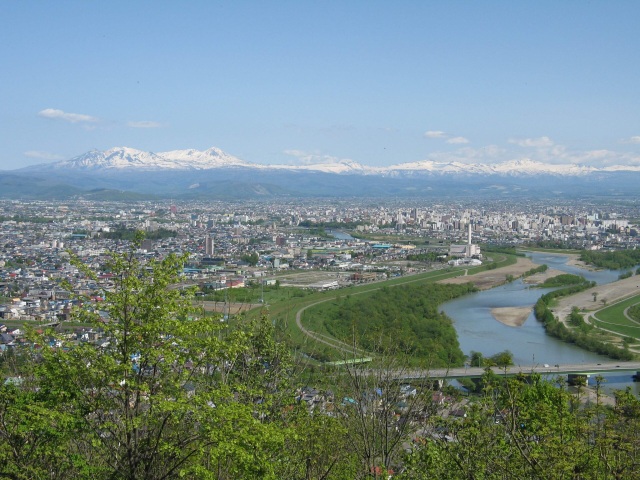
- Asahikawa Tokiwa Rotary
- This iconic circular intersection is a symbol of Asahikawa. Centered around a tower, it connects t…
-
- Asahikawa, Sounkyo, Tenninkyo
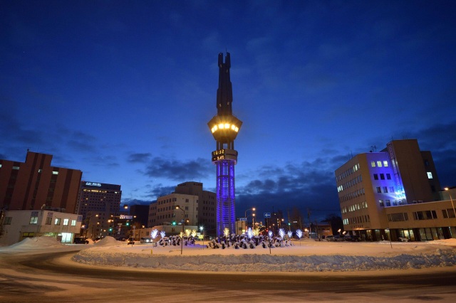
- detail_13164.html
- Tsubetsu Pass Observation Deck
- Perched at 947 meters, the Tsubetsu Pass Observation Deck offers an unparalleled view of one of Ho…
-
- Shiretoko, Abashiri, Monbetsu
- detail_12242.html
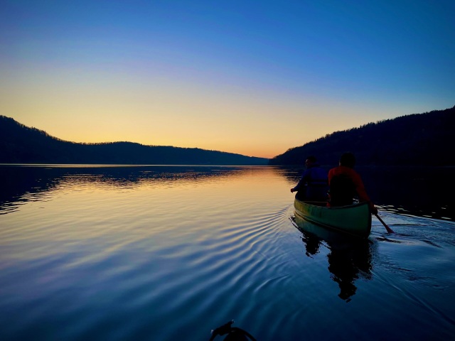
- Sapporo Lake
- Experience the breathtaking seasonal beauty of this serene reservoir, created by the Jozankei Dam …
-
- Sapporo/Jozankei
- detail_11184.html
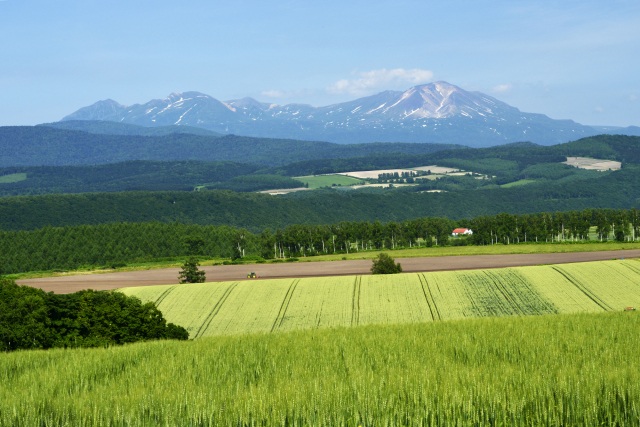
- Miyama Pass Observation Terrace
- Panoramic Views of the Tokachi-dake Mountain Range Meet Immersive Art and Local FlavorsLocated on …
-
- Area around Furano, Biei
- detail_10322.html
- Kiritappu Wetland
- Stroll along peaceful boardwalks where pristine wetlands stretch to the Pacific Ocean, alive with …
-
- Kushiro, Lake Akan, Lake Mashu, Nemuro
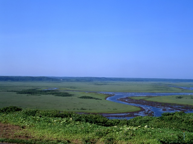
- detail_10475.html
- Shuujitsu Hill
- A scenic hilltop viewpoint offering sweeping views of Hokkaido’s iconic mountain ranges.Expe…
-
- Asahikawa, Sounkyo, Tenninkyo
- detail_10518.html
- The Ikeda-cho Grape and Wine Research Institute "Ikeda Win…
- Ikeda Wine Castle, with its European-style architecture, is a must-visit spot to experience the ch…
-
- Tokachi, Obihiro
- detail_10463.html
- Ishiyama Green Space
- Ishiyama Green Space (officially known as Ishiyama Open Space) is a unique park created from the f…
-
- Sapporo/Jozankei
- detail_10082.html
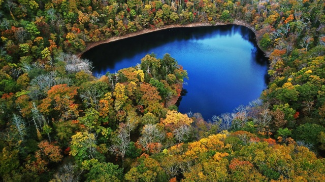
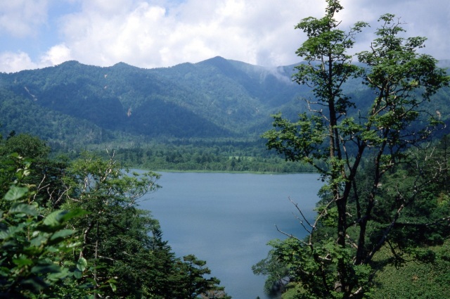
- Lake Toyoni
- Lake Toyoni is a rare natural wonder hidden deep within lush ancient forests. Viewed from above, i…
-
- Tokachi, Obihiro
- detail_12575.html
- Citizen's Forest
- Located on a hill in the Yunokawa area on the outskirts of Hakodate City, "Citizen's Fore…
-
- Hakodate, area around Hakodate
- detail_13049.html
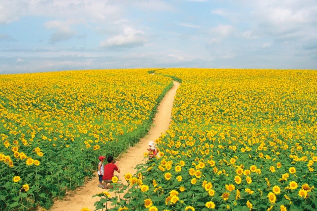
- Nayoro Sunflower Fields
- Experience one of Hokkaido's most spectacular summer landscapes in Nayoro, where around 5 mill…
-
- Asahikawa, Sounkyo, Tenninkyo
- detail_12876.html
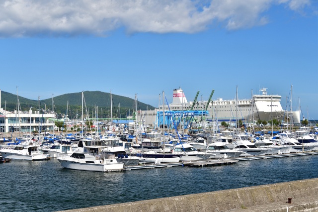
- Otaru Port Marina
- Discover the thrill of the sea at this hands-on marina, designed for everyone to enjoy without nee…
-
- Area around Otaru, Niseko
- detail_10220.html
- Onneto Hot Spring Waterfall
- Hidden within the forests surrounding the mystical Lake Onneto, this spectacular waterfall offers …
-
- Tokachi, Obihiro

- detail_10468.html
- Arashiyama Observatory
- Located on a scenic hill, this prime vantage point in Asahikawa offers a sweeping view of the gran…
-
- Asahikawa, Sounkyo, Tenninkyo
- detail_13192.html
- Lake Chubetsu
- Admire the breathtaking mirror-like reflection of Mt. Asahidake on the glass-like water, and the e…
-
- Asahikawa, Sounkyo, Tenninkyo
- detail_13168.html
- Shiretoko World Heritage Rusa Field House
- At the "Shiretoko World Heritage Rusa Field House," mountaineers and sea kayakers (navig…
-
- Shiretoko, Abashiri, Monbetsu
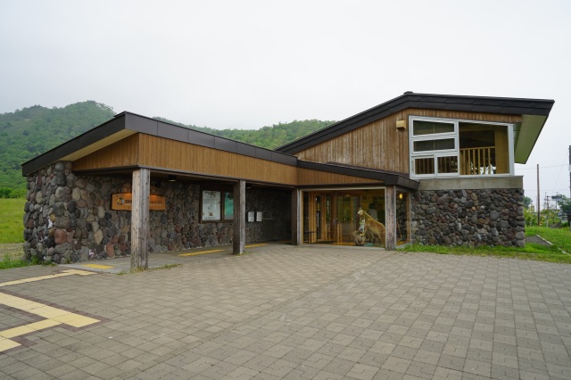
- detail_10505.html
- Cape Erimo Wind Museum
- At the far end of Japan’s northern frontier, where the “backbone of Hokkaido”&md…
-
- Area around Toya, Noboribetsu, and Hidaka
- detail_10440.html
- Harvester Yakumo
- This restaurant is located on a hill overlooking Funka Bay. Yakumo is the birthplace of Japanese H…
-
- Hakodate, area around Hakodate
- detail_12873.html
- Usu-Zenkoji Temple
- Discover a peaceful sanctuary shaped by seasonal beauty and deep heritage at Usu Zenkoji Temple, a…
-
- Area around Toya, Noboribetsu, and Hidaka
- detail_11239.html
- Lake Okotanpe
- Experience the mystical, shifting hues of Lake Okotanpe, one of Hokkaido’s three most seclud…
-
- Area around Sapporo
- detail_10284.html