Search conditions
Category
Area
Central Hokkaido
- Sapporo/Jozankei
- Sapporo Hitsujigaoka Observation Hill, Mount Moiwa, Hoheikyo Dam, etc.
- Area around Sapporo
- Lake Shikotsu, Northern Horse Park, Lake Katsurazawa, etc.
- Area around Otaru, Niseko
- Otaru Canal, Shakotan Peninsula, Mount Yotei, outdoor experiences, etc.
- Area around Toya, Noboribetsu, and Hidaka
- Lake Toya, Mount Usu, Jigokudani, Cape Erimo, etc.
Southern Hokkaido
- Hakodate, area around Hakodate
- Mount Hakodate, Hakodate morning market, Goryokaku Park, Onuma Quasi-National Park
- Matsumae, Esashi, Okushiri
- Matsumae Castle, Former Nakamura Family Merchant House, Okushiri Island
Northern Hokkaido
- Asahikawa, Sounkyo, Tenninkyo
- Asahiyama Zoo, Kurodake, Asahidake, Tohma Limestone Cave, etc.
- Area around Furano, Biei
- Lavender Farm, Blue Pond, Unkai Terrace, etc.
- Wakkanai, Rishiri, Rebun, Rumoi
- Cape Soya, Path of White Shells, Rebun Island, Rishiri Island, Kunimare Sake Brewery, etc.
Eastern Hokkaido
- Shiretoko, Abashiri, Monbetsu
- Shiretoko Five Lakes, whale watching, drift ice, Abashiri Prison Museum, Road to the Sky, etc.
- Tokachi, Obihiro
- Gardens, Mikuni Pass, Lake Shikaribetsu, Lake Onneto, etc.
- Kushiro, Lake Akan, Lake Mashu, Nemuro
- Kushiroshitsugen National Park, Lake Akan, Lake Mashu, Lake Kussharo, Cape Nosappu, etc.
Distance
検索結果
We found 305 results
- Sort by
- Popularity
- Last Updated Date
- The Closest Location
- Tokachi Makiba no Ie
- Escape to a countryside retreat surrounded by endless green landscapes, where you can enjoy local …
-
- Tokachi, Obihiro
- detail_10466.html
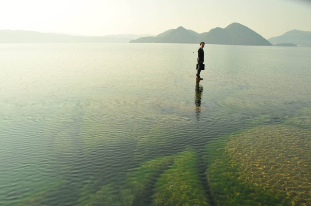
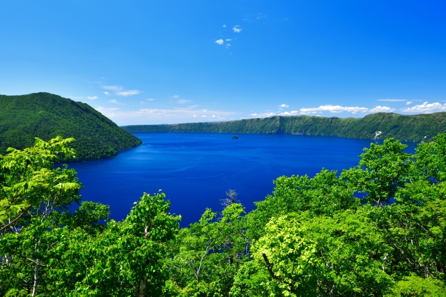
- Kame Rock, Lake Toya
- Emerging just above the surface of Lake Toya, Kame Rock is named for its resemblance to a turtle s…
-
- Area around Toya, Noboribetsu, and Hidaka
- detail_12875.html
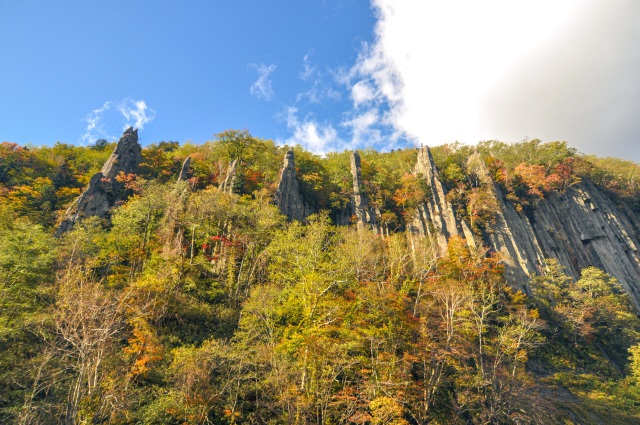
- Teninkyo Gorge: Shichifuku-iwa
- Discover the dramatic beauty of Shichifuku-iwa (Seven Lucky Gods Rock), seven majestic pillars sha…
-
- Asahikawa, Sounkyo, Tenninkyo
- detail_13212.html
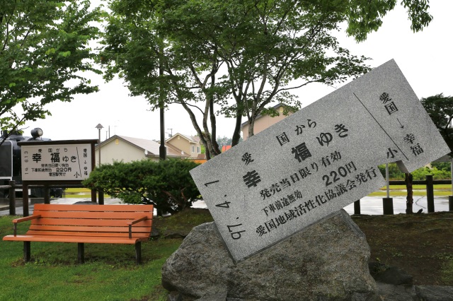
- Aikoku Station
- Capture the Giant Ticket of Happiness and Cherish Warm Memories in Hokkaido!Aikoku Station became …
-
- Tokachi, Obihiro
- detail_10130.html
- Kamome Island
- Designated as a special area within Hiyama Prefectural Natural Park, Kamome Island is a symbolic l…
-
- Matsumae, Esashi, Okushiri
- detail_10314.html
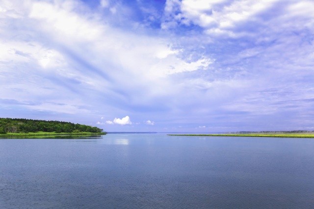
- Lake Furen
- Lake Furen is a magnificent brackish lake, with a shoreline stretching about 96 kilometers. Recogn…
-
- Kushiro, Lake Akan, Lake Mashu, Nemuro
- detail_10141.html
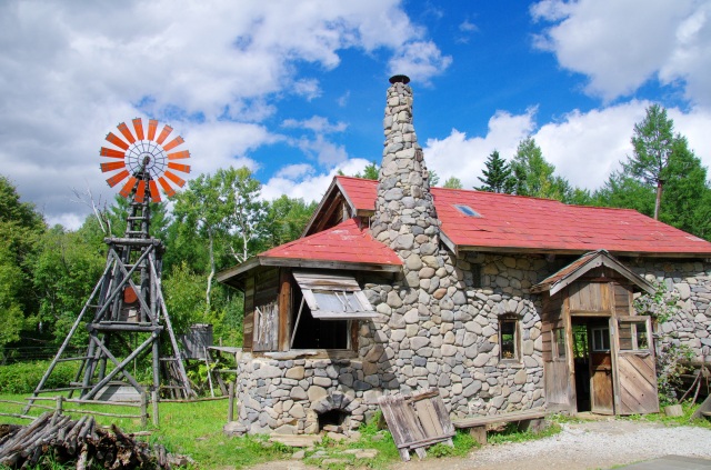
- Goro's Stone House and First House
- Discover the hand-built stone house of Kuroita Goro from the iconic TV drama "Kita no Kuni ka…
-
- Area around Furano, Biei
- detail_10021.html
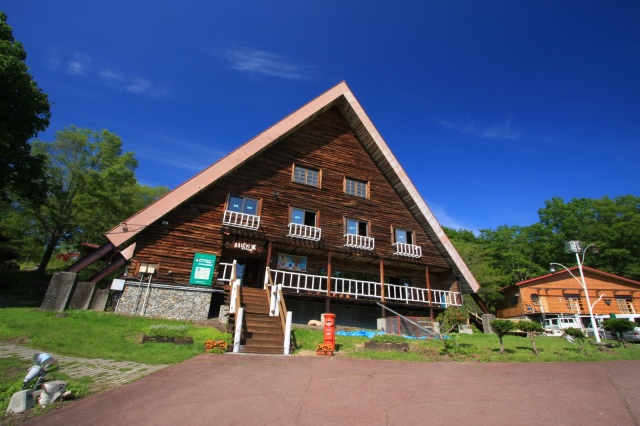
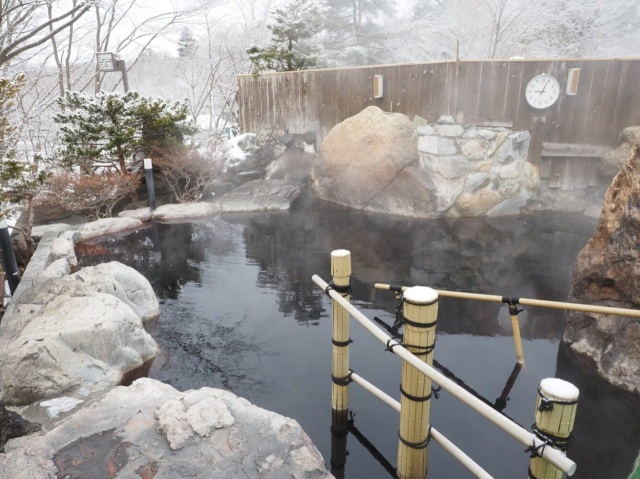
- Takeyama Kogen Hot Spring (Temporarily Closed for Renovati…
- Discover a tranquil highland retreat near Sapporo, known for its striking rock-built open-air bath…
-
- Area around Sapporo
- detail_10638.html
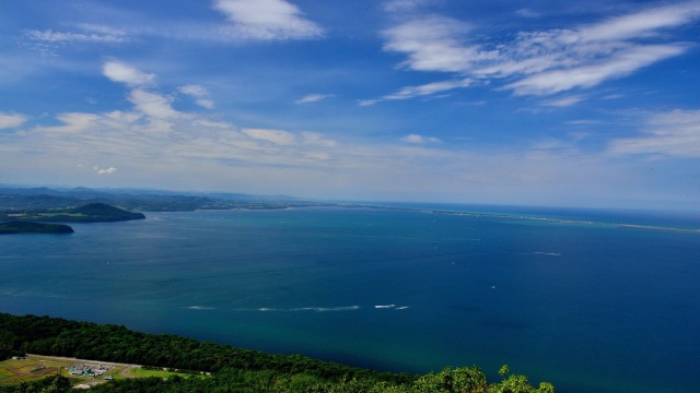
- Lake Saroma Observation Deck
- Perched 376 meters above sea level near the heart of Lake Saroma’s shoreline, this observati…
-
- Shiretoko, Abashiri, Monbetsu
- detail_10421.html
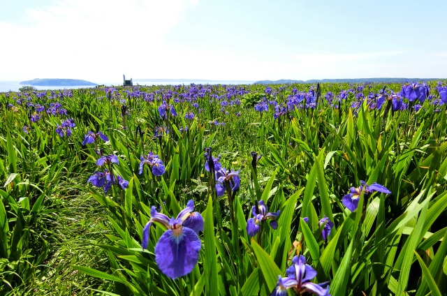
- Genseikaen Ayamegahara & Akkeshi Ayame Festival
- About 300,000 hiougi irises bloom in full glory at this breathtaking scenic spot, where a vast 100…
-
- Kushiro, Lake Akan, Lake Mashu, Nemuro
- detail_10470.html
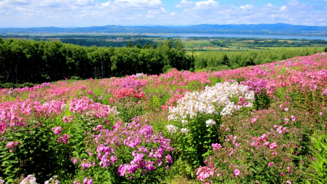
- Abashiri Phlox Park
- This open garden park offers a breathtaking 360-degree view of Lake Abashiri. With 150,000 vibrant…
-
- Shiretoko, Abashiri, Monbetsu
- detail_11437.html
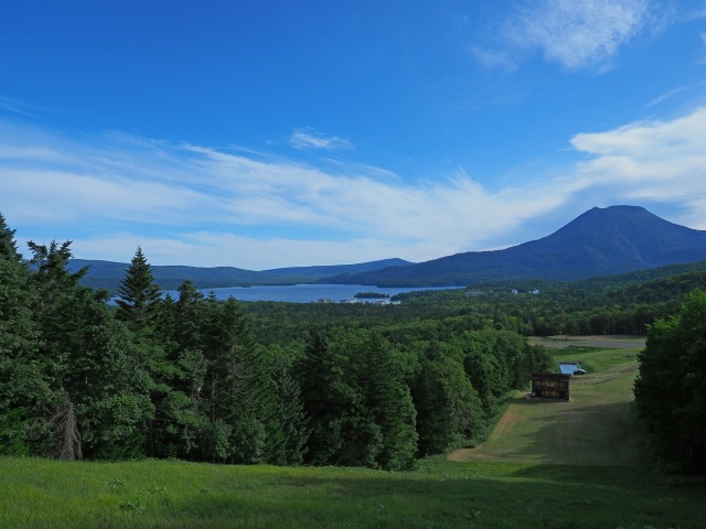
- Akankohan Viewpoint
- Perched at about 530 meters and just 2 kilometers from the Lake Akan hot spring town, Akankohan Vi…
-
- Kushiro, Lake Akan, Lake Mashu, Nemuro
- detail_10246.html
- Kottaro Marsh Observatory
- Discover the raw, original beauty of Kushiro Marsh from one of its most unspoiled vantage points. …
-
- Kushiro, Lake Akan, Lake Mashu, Nemuro
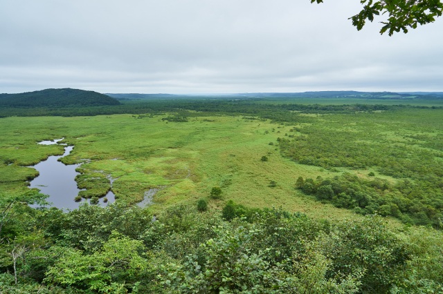
- detail_10480.html
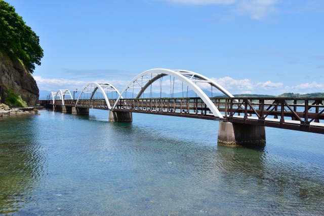
- Hakucho Ohashi Bridge
- Spanning 1,380 meters across Muroran Port, Hakucho Ohashi Bridge is the largest suspension bridge …
-
- Area around Toya, Noboribetsu, and Hidaka
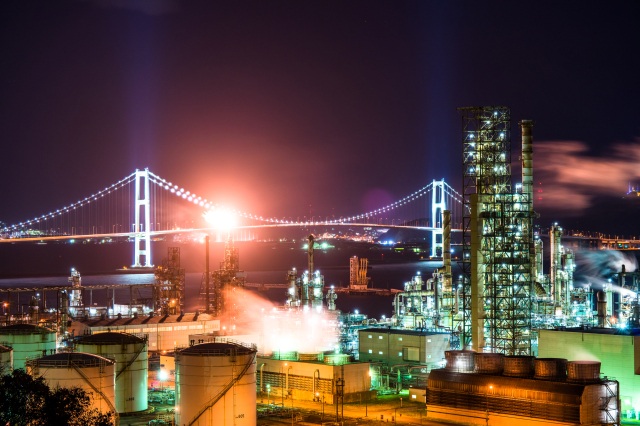
- detail_10195.html
- Ogigahara Observatory
- Soar above the Tokachi Plain from a breathtaking 800-meter vantage point.Located along Prefectural…
-
- Tokachi, Obihiro
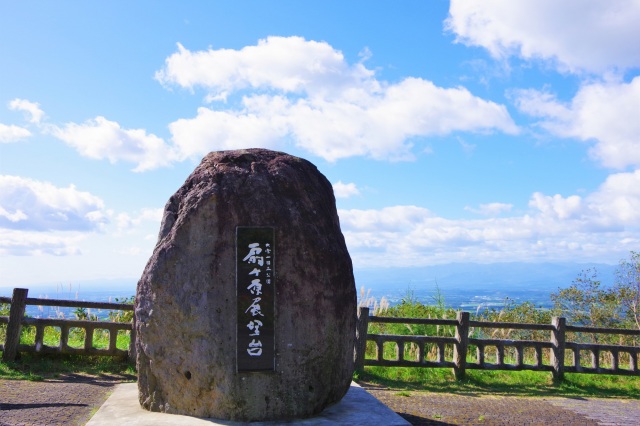
- detail_10452.html
- Shunkunitai Wild Bird Sanctuary Nature Center
- Experience a 600-hectare natural marvel where rare spruce forests, tidal flats, and 340 bird speci…
-
- Kushiro, Lake Akan, Lake Mashu, Nemuro
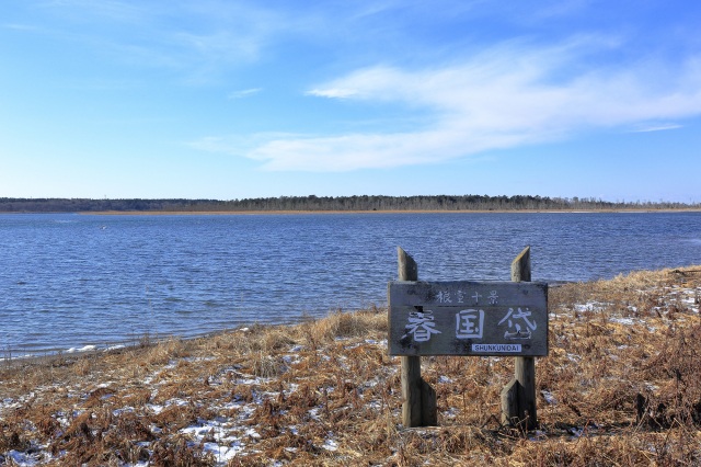
- detail_10143.html
- Uramashu Observatory
- A hidden viewpoint with clear skies and a mystical view of Lake Mashu.Uramashu Observatory sits at…
-
- Kushiro, Lake Akan, Lake Mashu, Nemuro
- detail_10415.html
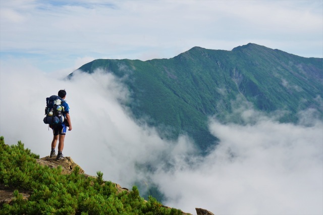
- Mt. Poroshiri
- Mt. Poroshiri means "big mountain" in Ainu and is the only mountain in the Hidaka Range …
-
- Area around Toya, Noboribetsu, and Hidaka
- detail_13076.html
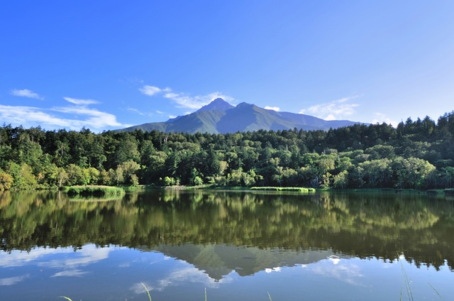
- Himenuma Pond
- Witness the breathtaking "Inverted Rishiri Fuji" reflected on a serene, emerald pond.Him…
-
- Wakkanai, Rishiri, Rebun, Rumoi
- detail_10394.html
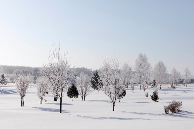
- Hokkaido Sunpillar Park
- A nature-rich regional park in Nayoro. Its main attractions are the sunflower fields that bloom in…
-
- Asahikawa, Sounkyo, Tenninkyo
- detail_11272.html