Search conditions
Category
Area
Central Hokkaido
- Sapporo/Jozankei
- Sapporo Hitsujigaoka Observation Hill, Mount Moiwa, Hoheikyo Dam, etc.
- Area around Sapporo
- Lake Shikotsu, Northern Horse Park, Lake Katsurazawa, etc.
- Area around Otaru, Niseko
- Otaru Canal, Shakotan Peninsula, Mount Yotei, outdoor experiences, etc.
- Area around Toya, Noboribetsu, and Hidaka
- Lake Toya, Mount Usu, Jigokudani, Cape Erimo, etc.
Southern Hokkaido
- Hakodate, area around Hakodate
- Mount Hakodate, Hakodate morning market, Goryokaku Park, Onuma Quasi-National Park
- Matsumae, Esashi, Okushiri
- Matsumae Castle, Former Nakamura Family Merchant House, Okushiri Island
Northern Hokkaido
- Asahikawa, Sounkyo, Tenninkyo
- Asahiyama Zoo, Kurodake, Asahidake, Tohma Limestone Cave, etc.
- Area around Furano, Biei
- Lavender Farm, Blue Pond, Unkai Terrace, etc.
- Wakkanai, Rishiri, Rebun, Rumoi
- Cape Soya, Path of White Shells, Rebun Island, Rishiri Island, Kunimare Sake Brewery, etc.
Eastern Hokkaido
- Shiretoko, Abashiri, Monbetsu
- Shiretoko Five Lakes, whale watching, drift ice, Abashiri Prison Museum, Road to the Sky, etc.
- Tokachi, Obihiro
- Gardens, Mikuni Pass, Lake Shikaribetsu, Lake Onneto, etc.
- Kushiro, Lake Akan, Lake Mashu, Nemuro
- Kushiroshitsugen National Park, Lake Akan, Lake Mashu, Lake Kussharo, Cape Nosappu, etc.
Distance
検索結果
We found 184 results
- Sort by
- Popularity
- Last Updated Date
- The Closest Location
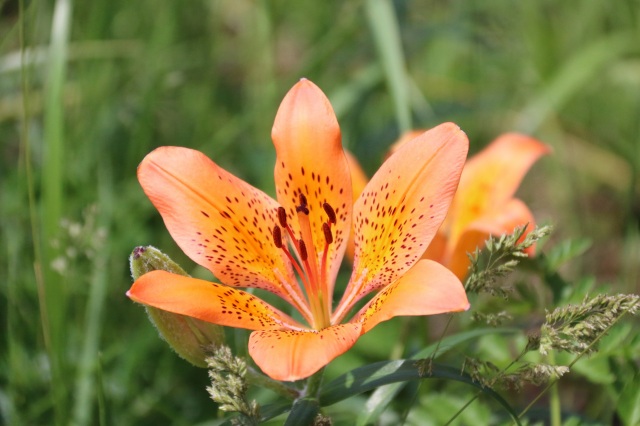
- Sapporo Lake
- Experience the breathtaking seasonal beauty of this serene reservoir, created by the Jozankei Dam …
-
- Sapporo/Jozankei
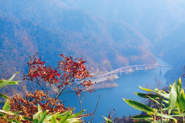
- detail_11184.html
- The Ikeda-cho Grape and Wine Research Institute "Ikeda Win…
- Ikeda Wine Castle, with its European-style architecture, is a must-visit spot to experience the ch…
-
- Tokachi, Obihiro
- detail_10463.html
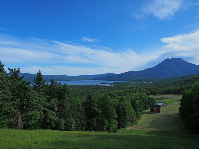
- Onuma Yusen
- Set against the stunning backdrop of Mt. Komagatake’s jagged peaks, this scenic cruise invit…
-
- Hakodate, area around Hakodate
- detail_10298.html
- Former Aoyama Villa(Otaru Kihinkan)
- Relive the Taisho-era romance at this nationally registered Tangible Cultural Property. Built over…
-
- Area around Otaru, Niseko
- detail_10041.html
- Koshimizu Genseikaen Wildflower Park
- Discover a coastal paradise where over 200 species of wildflowers blanket the dunes between the Se…
-
- Shiretoko, Abashiri, Monbetsu
- detail_10419.html
- Tokachi Farm White Birch Avenue
- Indulge in a sensory journey along an elegant avenue of white birch trees. With each step, the gen…
-
- Tokachi, Obihiro
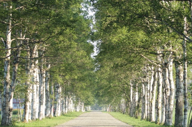
- detail_10523.html
- Rebun Usuyukiso Flower Colony
- Discover the ethereal beauty of Rebun Usuyukiso, a delicate white wonder blooming along a scenic i…
-
- Wakkanai, Rishiri, Rebun, Rumoi
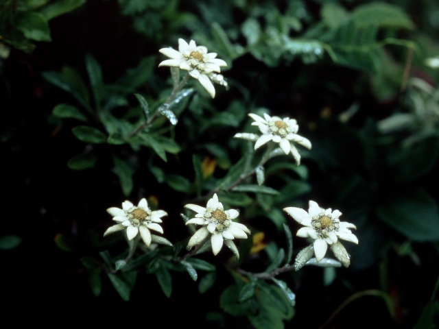
- detail_10537.html
- Lake Saroma Wakka Wild Flower Garden
- Pedal through a vibrant tapestry of 300 wildflower species on this narrow coastal path, a designat…
-
- Shiretoko, Abashiri, Monbetsu
- detail_10132.html
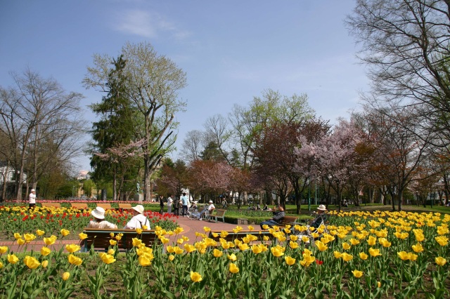
- Tokiwa Park
- Tokiwa Park, established in 1910 as the first park in Asahikawa, is a sprawling 16-hectare retreat…
-
- Asahikawa, Sounkyo, Tenninkyo
- detail_13191.html
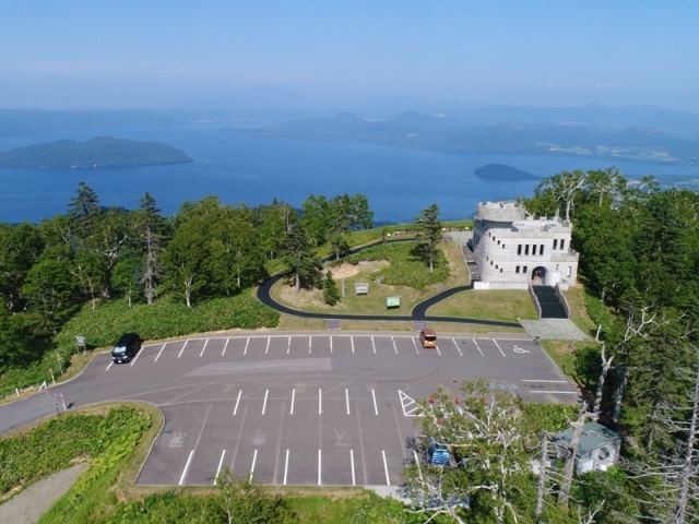
- Akankohan Viewpoint
- Perched at about 530 meters and just 2 kilometers from the Lake Akan hot spring town, Akankohan Vi…
-
- Kushiro, Lake Akan, Lake Mashu, Nemuro
- detail_10246.html
- Asahigaoka Park
- Asahigaoka Park, perched on a scenic hill in the Memanbetsu area, offers a breathtaking 360-degree…
-
- Shiretoko, Abashiri, Monbetsu
- detail_11310.html
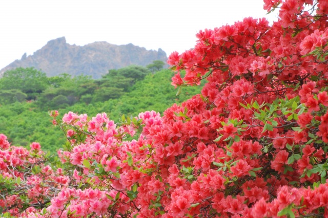
- Mt. Esan
- Experience sweeping ocean views and vibrant spring azaleas from the summit of this living 617‑mete…
-
- Hakodate, area around Hakodate
- detail_10096.html
- Tsubetsu Pass Observation Deck
- Perched at 947 meters, the Tsubetsu Pass Observation Deck offers an unparalleled view of one of Ho…
-
- Shiretoko, Abashiri, Monbetsu
- detail_12242.html
- Todowara
- Notsuke Peninsula is home to Todowara, where weathered fir trees stand like silent sculptures shap…
-
- Kushiro, Lake Akan, Lake Mashu, Nemuro
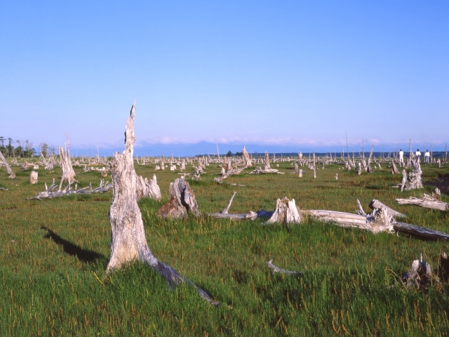
- detail_10496.html
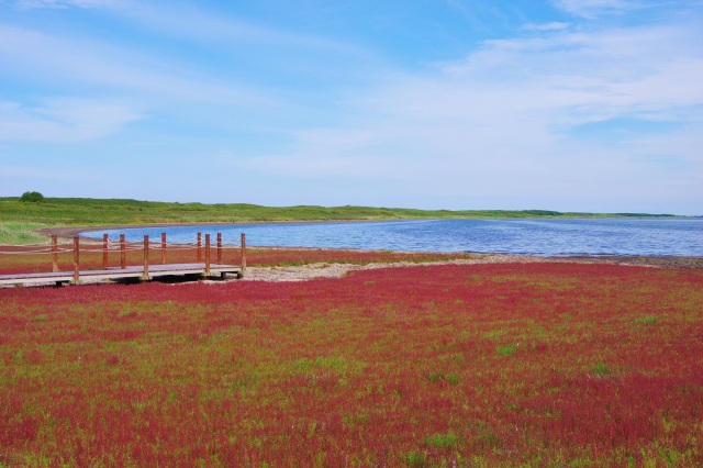
- Genseikaen Ayamegahara & Akkeshi Ayame Festival
- About 300,000 hiougi irises bloom in full glory at this breathtaking scenic spot, where a vast 100…
-
- Kushiro, Lake Akan, Lake Mashu, Nemuro
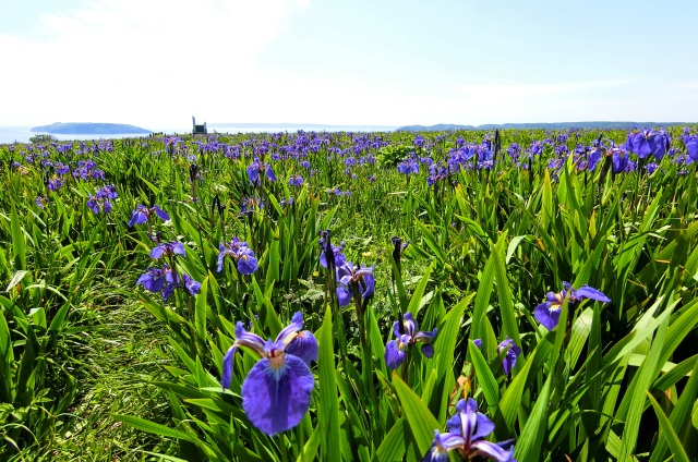
- detail_10470.html
- Märchen Hill (Fairy Tale Hill)
- On a gently rolling hill in Ozora Town, seven larch trees stand in a straight row, creating a poet…
-
- Shiretoko, Abashiri, Monbetsu
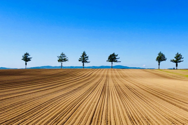
- detail_11234.html
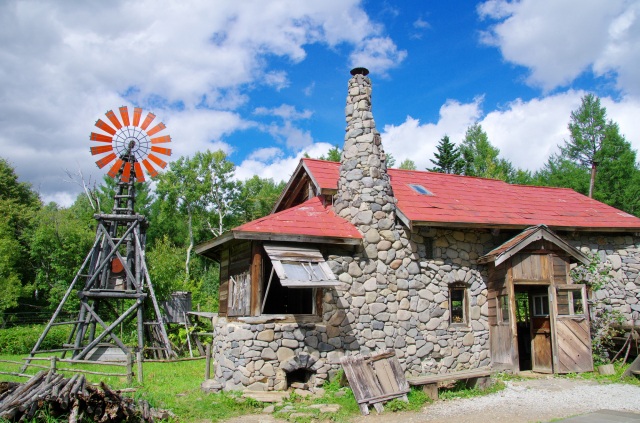
- Goro's Stone House and First House
- Discover the hand-built stone house of Kuroita Goro from the iconic TV drama "Kita no Kuni ka…
-
- Area around Furano, Biei
- detail_10021.html
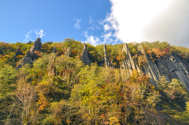
- Teninkyo Gorge: Shichifuku-iwa
- Discover the dramatic beauty of Shichifuku-iwa (Seven Lucky Gods Rock), seven majestic pillars sha…
-
- Asahikawa, Sounkyo, Tenninkyo
- detail_13212.html
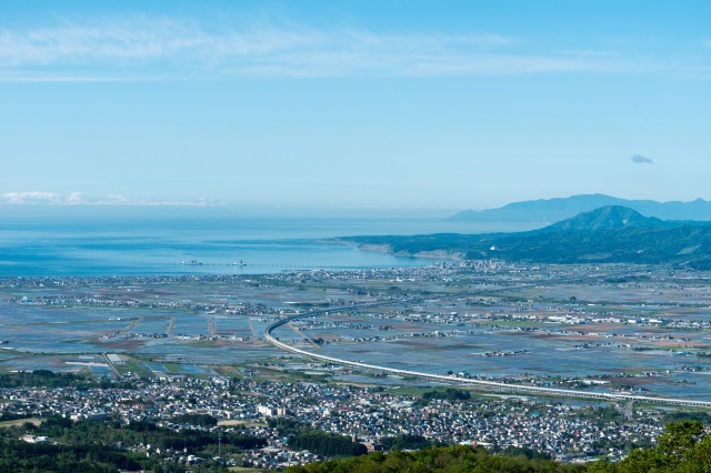
- Shirotai Ranch Observatory & Shirotai Skyline
- Perched 550 meters above sea level, this expansive ranch offers a breathtaking panorama of Mt. Kom…
-
- Hakodate, area around Hakodate
- detail_10526.html
- Esanuka Line
- The Esanuka Line in Sarufutsu Village stretches about 16km across the Asachino Plateau, forming on…
-
- Wakkanai, Rishiri, Rebun, Rumoi

- detail_11233.html