Search conditions
Category
Area
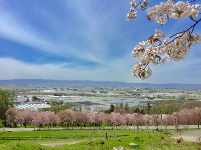
Central Hokkaido
- Sapporo/Jozankei
- Sapporo Hitsujigaoka Observation Hill, Mount Moiwa, Hoheikyo Dam, etc.
- Area around Sapporo
- Lake Shikotsu, Northern Horse Park, Lake Katsurazawa, etc.
- Area around Otaru, Niseko
- Otaru Canal, Shakotan Peninsula, Mount Yotei, outdoor experiences, etc.
- Area around Toya, Noboribetsu, and Hidaka
- Lake Toya, Mount Usu, Jigokudani, Cape Erimo, etc.
Southern Hokkaido
- Hakodate, area around Hakodate
- Mount Hakodate, Hakodate morning market, Goryokaku Park, Onuma Quasi-National Park
- Matsumae, Esashi, Okushiri
- Matsumae Castle, Former Nakamura Family Merchant House, Okushiri Island
Northern Hokkaido
- Asahikawa, Sounkyo, Tenninkyo
- Asahiyama Zoo, Kurodake, Asahidake, Tohma Limestone Cave, etc.
- Area around Furano, Biei
- Lavender Farm, Blue Pond, Unkai Terrace, etc.
- Wakkanai, Rishiri, Rebun, Rumoi
- Cape Soya, Path of White Shells, Rebun Island, Rishiri Island, Kunimare Sake Brewery, etc.
Eastern Hokkaido
- Shiretoko, Abashiri, Monbetsu
- Shiretoko Five Lakes, whale watching, drift ice, Abashiri Prison Museum, Road to the Sky, etc.
- Tokachi, Obihiro
- Gardens, Mikuni Pass, Lake Shikaribetsu, Lake Onneto, etc.
- Kushiro, Lake Akan, Lake Mashu, Nemuro
- Kushiroshitsugen National Park, Lake Akan, Lake Mashu, Lake Kussharo, Cape Nosappu, etc.
Distance
- 現在の条件指定
- Northern Hokkaido
検索結果
We found 174 results
- Sort by
- Popularity
- Last Updated Date
- The Closest Location
- Kamui no Mori Park
- An expansive family park surrounded by lush forests where children can learn through play at the &…
-
- Asahikawa, Sounkyo, Tenninkyo
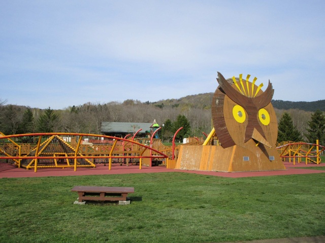
- detail_13189.html
- Lake Kanayama
- A tranquil lake surrounded by mountains, offering outdoor experiences and relaxing moments in harm…
-
- Area around Furano, Biei
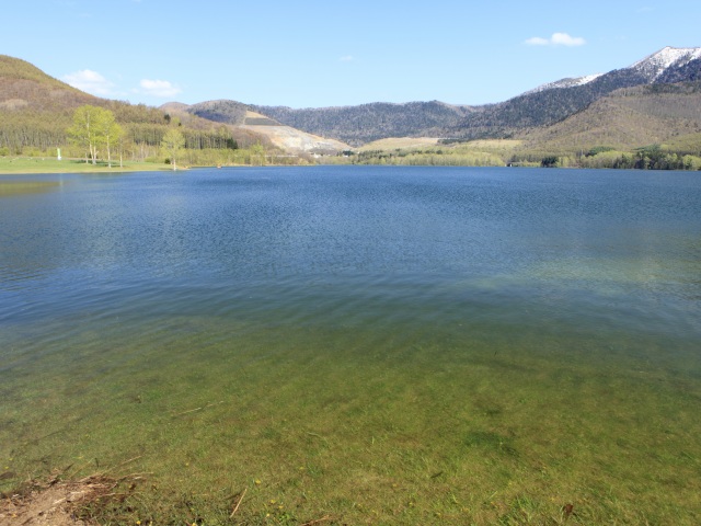
- detail_12182.html
- Kanno Farm
- Experience the vibrant waves of flowers and the iconic "ARASHI Tree" along the scenic Ha…
-
- Area around Furano, Biei
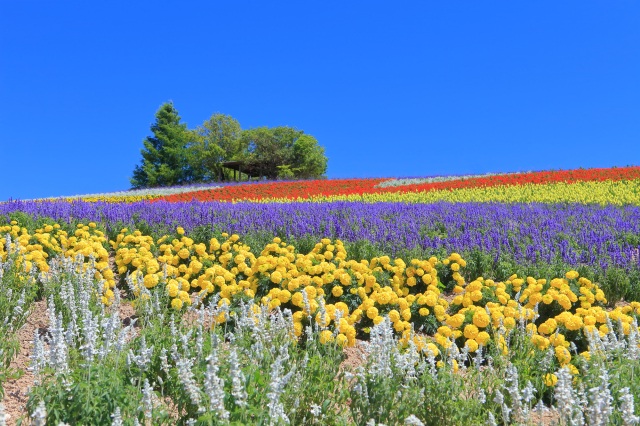
- detail_10168.html
- Takushinkan Gallery
- Takushinkan Gallery offers a rare glimpse into the eyes of Shinzo Maeda, the legendary landscape p…
-
- Area around Furano, Biei
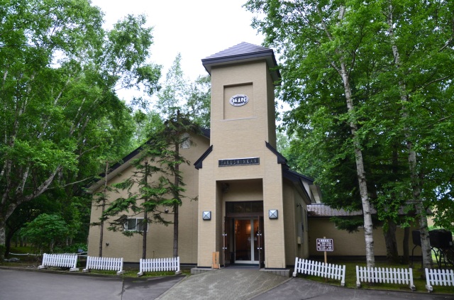
- detail_10360.html
- White Birch Road
- Stretching for nearly 4 km toward Shirogane Hot Spring, a graceful avenue of white birch trees wel…
-
- Area around Furano, Biei
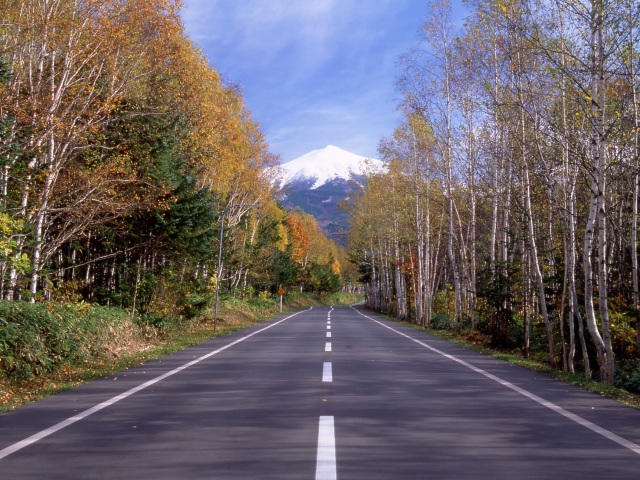
- detail_10359.html
- Soya Hills
- Walk along the snow-white scallop shell paths of Japan’s northernmost periglacial landscape.…
-
- Wakkanai, Rishiri, Rebun, Rumoi
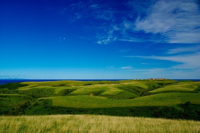
- detail_10533.html
- Wakkanai Fukko Market
- Savor fresh seafood and explore Sakhalin’s heritage at Japan's northern edge.Experience …
-
- Wakkanai, Rishiri, Rebun, Rumoi
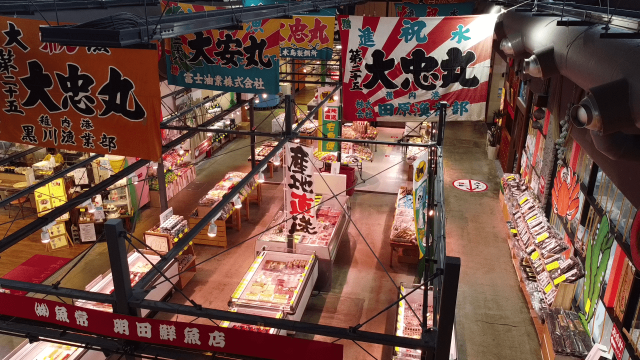
- detail_11269.html
- Wakkanai West Coast Ororon Line
- A road where the sky meets the sea, guided by the silhouette of Mt. Rishiri.Experience the ultimat…
-
- Wakkanai, Rishiri, Rebun, Rumoi
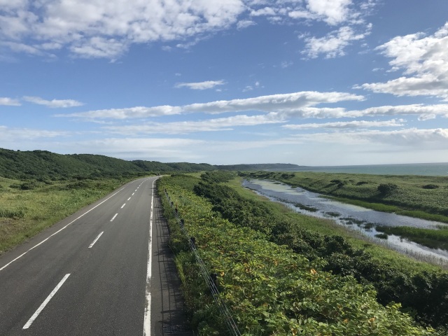
- detail_11363.html
- Kitoushi Forest
- Experience the breathtaking scale of Kitoushi Forest, where ancient geological wonders meet season…
-
- Asahikawa, Sounkyo, Tenninkyo
- detail_13177.html
- Asahikawa Design Center
- Experience the pinnacle of Asahikawa furniture at this premier design hub. Immerse yourself in the…
-
- Asahikawa, Sounkyo, Tenninkyo
- detail_13181.html
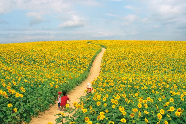
- Nayoro Sunflower Fields
- Experience one of Hokkaido's most spectacular summer landscapes in Nayoro, where around 5 mill…
-
- Asahikawa, Sounkyo, Tenninkyo
- detail_12876.html
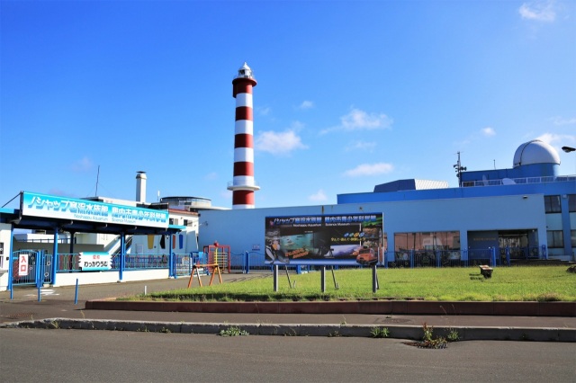
- Wakkarium Noshappu Aquarium
- Wakkarium, located near the scenic Cape Noshappu, is home to about 100 species and 1,500 marine an…
-
- Wakkanai, Rishiri, Rebun, Rumoi
- detail_10278.html
- Kaikugama Gallery
- Nestled in the serene birch forests of Shirogane, Biei, Kaikugama Gallery brings the beauty of the…
-
- Area around Furano, Biei
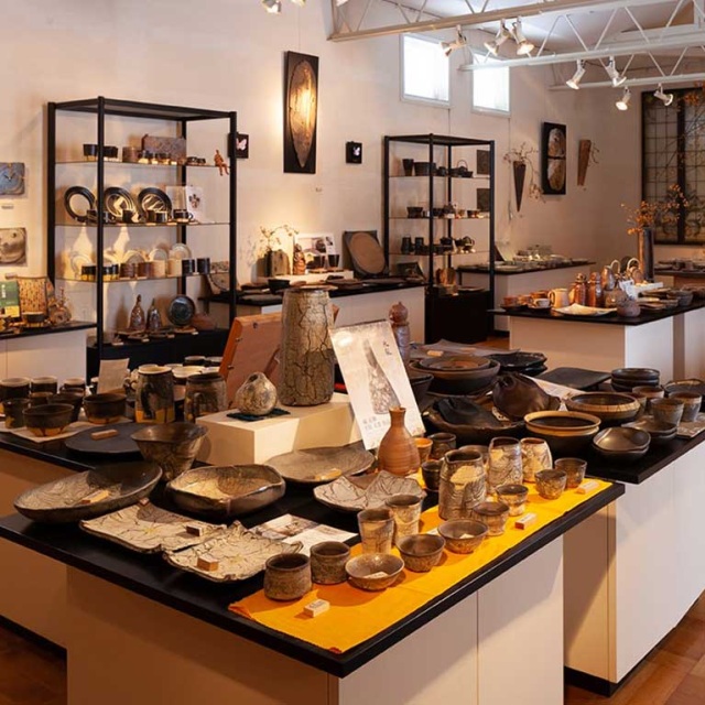
- detail_13157.html
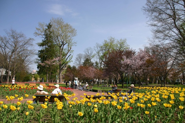
- Asahikawa Kitasaito Garden
- Located just steps from the station, this urban oasis seamlessly blends the natural beauty of the …
-
- Asahikawa, Sounkyo, Tenninkyo
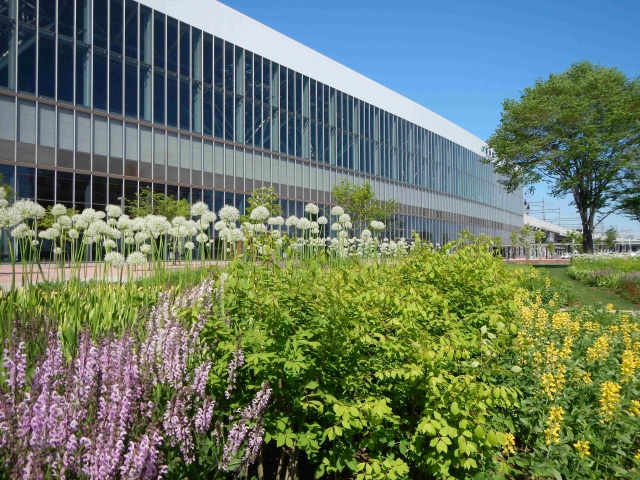
- detail_13170.html
- Canmore Ski Village
- Experience world-class snow with unbeatable convenience. Located just 15 minutes by car from Asahi…
-
- Asahikawa, Sounkyo, Tenninkyo
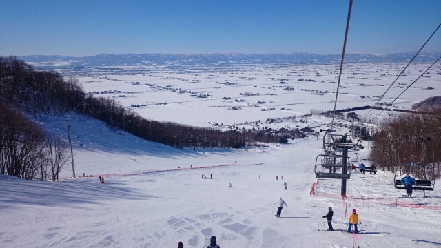
- detail_13198.html
- Asahikawa Science Center "Sci-Pal"
- As Hokkaido's largest science center, Sci-Pal invites visitors to explore the three themes of …
-
- Asahikawa, Sounkyo, Tenninkyo
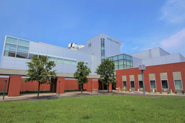
- detail_10235.html
- Rebun Usuyukiso Flower Colony
- Discover the ethereal beauty of Rebun Usuyukiso, a delicate white wonder blooming along a scenic i…
-
- Wakkanai, Rishiri, Rebun, Rumoi
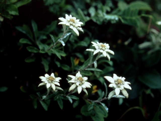
- detail_10537.html
- Kamui Ski Links
- A sprawling ski resort boasting light, airy snow and panoramic vistas that stretch to the horizon.…
-
- Asahikawa, Sounkyo, Tenninkyo
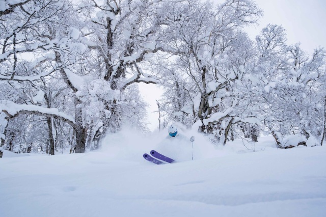
- detail_13195.html
- Furano Ice Milk Studio
- Enjoy freshly made milk gelato crafted from local Furano Milk and inspired by the region’s s…
-
- Area around Furano, Biei
- detail_10292.html
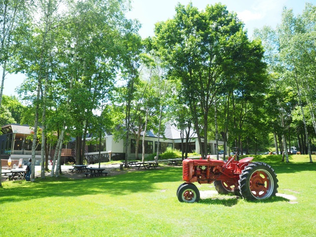
- Tokiwa Park
- Tokiwa Park, established in 1910 as the first park in Asahikawa, is a sprawling 16-hectare retreat…
-
- Asahikawa, Sounkyo, Tenninkyo
- detail_13191.html